The Norwegian Geotechnical Institute gets support to develop an application for remote sensing of the coastal ice, called IceView.
The IceView project is led by the Norwegian Geotechnical Institute (NGI) with the goal to develop algorithms to continuously map coastal ice using InSAR, a technique that enables observations of small movements from space. The Alfred Wegner Institute in Germany and the Norwegian Ice Service are partners in the project to validate and implement the product for operational ice mapping. IceView has also gained support by the Svalbard Integrated Arctic Earth Observing System (SIOS) due to the relevance of the project to environmental monitoring in Svalbard.
Now IceView has been granted as the first ever project supported by the Arctic Phi-Lab, the innovation hub in Norway established by European Space Agency (ESA) and a consortium of NORCE, Kongsberg Satellite Services (KSAT), UiT – The Arctic University of Norway, Norinnova and Akvaplan-niva. Its mission is to accelerate the future of earth observation through disruptive and transformational innovation.
“We are thrilled about the first project to be accepted by ESA Phi-Lab Norway. Our mission is to help develop innovative earth observation applications for the Arctic region through funding and support from partner organizations. We look forward to following this exciting pilot project,” says Trude Nilsen, head of the ESA Phi-Lab Norway.
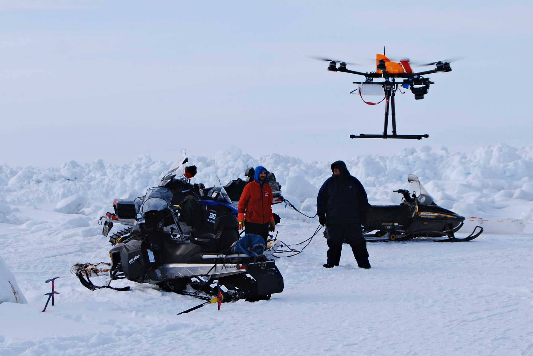
The project leader and head of remote sensing at NGI, Dyre Dammann, stresses the value of mapping the part of the coastal ice that is attached to shore, known as landfast ice. This ice plays a pivotal role for Arctic marine ecosystems as it extends the land seasonally and provides a platform for marine mammal habitats, industry or logistics operations, and coastal communities. Landfast ice can also serve as a climate regulator, erosion protector and impact shipping.
Today there is limited information about what part of coastal ice is in fact landfast and how it has been impacted by recent sea ice decline, as this type of ice can be difficult to identify.
The team behind IceView is now setting out to create an operational product to map landfast ice extent and also its stability using InSAR with the help from Arctic Phi-lab.
“NGI is in currently strengthening Arctic R&D through our new office in Tromsø and we are therefore especially excited to develop this new and improved method for ice monitoring together with ESA Phi-Lab Norway”, says Dyre Dammann.
In addition to becoming a valuable component of the long-term monitoring of Svalbard’s environment by SIOS, IceView will be offered as a service to industry operating either on or near coastal sea ice throughout the Arctic. The service will be provided by Inio (inio.ai) – the InSAR satellite service by NGI and KSAT.
About the Arctic Phi-Lab Norway:
Arctic Phi-Lab is a newly established innovation center aimed at developing cutting-edge technology in earth observation, with a particular focus on Arctic challenges. The initiative is driven by key actors within Tromsø’s earth observation community, with Kongsberg Satellite Service, NORCE, UiT – The Arctic University of Norway, Norinnova, and Akvaplan-niva at the forefront. The Arctic Phi-Lab is funded 50% by the European Space Agency and 50 % by national and local actors through the five consortium partners as well as Troms Fylkeskommune, SpareBank 1 Nord-Norge and Kongsberg Satellite Services.